Waves: Latest News

All news where Waves is mentioned
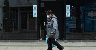
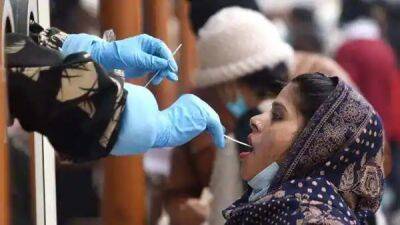
Advisory for Cyclonic storm “Mandous” - newsfirst.lk
newsfirst.lk
68%
902
Advisory for Cyclonic storm “Mandous”
COLOMBO (News 1st) – The Department of Meteorology says that the Severe Cyclonic storm “Mandous” lay centred over Southwest Bay of Bengal (250km northeast of Trincomalee) near latitude 10.4N and longitude 82.6E at 08.30 p.m yesterday (8). It is very likely to move west-northwestwards and cross North Tamil-Nadu, Puducherry and South Andhra Pradesh coast around mid-night of 09th December.Maximum wind speeds will be (70-90) kmph and can increase up to 100 kmph in sea areas between (06N – 15N, and 80E – 88E).Heavy showers or thundershowers and very rough to high seas can be expected in the aforementioned sea areas.There is a possibility that near-shore sea areas off the coast extending from Kankasanturai to Trincomalee via Mullaitivu may experience surges due to swell waves of (about 2.5 m – 3.5 m) height (This is not for the land area).Southern sea areas bounded by (02N – 06N, 80E – 88E) will be very rough at times and wind speeds will be (40-50) kmph and can increase up to 70 kmph in the Southern sea areas. The cyclonic storm “Mandous” over Southwest Bay of Bengal (300km northeast of Trincomalee) is located near latitude 9.5N and longitude 83.8E at 08.30 a.m. today (9). It is very likely to move west-northwestwards and cross North Tamil-Nadu, Puducherry and South Andhra Pradesh coast over the Southwest Bay of Bengal around midnight of 09th December.Cloudy skies will prevail over most parts of the Island.
Showers to be expected in several provinces during the day - newsfirst.lk - Sri Lanka - province North-Central
newsfirst.lk
55%
857
Showers to be expected in several provinces during the day
COLOMBO (News 1st) – Department of Meteorology says that the low-level atmospheric disturbance in the South-east of Sri Lanka has intensified into a low-pressure area. It is likely to develop further during the next 24 hours. Therefore, rainy conditions over most parts of the Island will expect to enhance. Cloudy skies can be expected in Northern, North-Central and Eastern provinces.Showers or thundershowers will occur at times in Eastern, Uva, Northern and North-Central provinces and the Matale district.Showers or thundershowers will occur elsewhere during the afternoon or night.Heavy showers above 100 mm can be expected at some places in Northern, North-Central Eastern, Sabaragamuwa and Southern provinces.The general public is kindly requested to take adequate precautions to minimize damages caused by temporary localized strong winds and lightning during thundershowers.The Low-level atmospheric disturbance in the South-east of Sri Lanka has intensified into a low-pressure area. It is likely to develop further during the next 24 hours and very likely to move northwestwards towards the Northern coast of Sri Lanka.Naval and fishing communities are advised not to venture into the deep and shallow sea areas off the coast extending from Batticaloa to Mannar via Trincomalee and Kankasanturai.Condition of Rain:Showers or thundershowers will occur at times in the sea areas off the coast extending from Pottuvil to Mannar via Batticaloa, Trincomalee and Kankasanturai. Showers or thundershowers will occur in other sea areas around the island during the afternoon or night. Winds:Winds will be North-easterly or variable in direction. Wind speed will be (20-30) kmph.
Sudarshana Pathirana - Airforce completes 7th Seed Bombing mission - newsfirst.lk - Sri Lanka - county Forest
newsfirst.lk
46%
451
Airforce completes 7th Seed Bombing mission
Colombo (News 1st) – The Sri Lanka Air Force under the guidance of the Commander of the Air Force, Air Marshal Sudarshana Pathirana together with the Faculty of Agriculture at the University of Peradeniya and Central Environment Authority launched the seventh wave of seed bombing at Wattegama Kebilitta Government Forest Reserve in the Siyamblanduwa Divisional Secretariat.The Command Agro Unit at SLAF Base Katunayake under the leadership of Group Captain PE Gunawardena and the Department of Forest Conservation organized this mission to achieve the aim of improving the forest density of Sri Lanka to reach the sustainable development goals of the country by increasing the forest cover from 27% to 32% by the year 2030.The first wave of the mission was executed at the Ranorawa government forest in a five acres land area and approximately 5,000 seed bombs were released. During the second wave, 67,000 seed bombs were dropped over a 60 acres area inside the forest of Lahugala in Ampara. The third wave which was conducted in December 2020 saw the dropping of approximately 30,000 seed bombs over 25 acres of land area within the Lahugala National Park. The fourth wave was carried out in the Lahugala National Park where 70,000 seed bombs were dropped over a 60-acre area. The fifth wave was carried out in the Kebilitta Government Forest Reserve where 80,000 seed bombs were dropped over a 75 acres area. Through the sixth wave, 65,000 seed bombs were dropped on over 70 acres of area inside the same forestry at Siyambalanduwa Divisional Secretariat.
Heavy rains expected today (6) - newsfirst.lk - province North-Western
newsfirst.lk
79%
133
Heavy rains expected today (6)
COLOMBO (News 1st) – The Department of Meteorology says several spells of showers will occur in Western, Sabaragamuwa, and North-Western provinces and Kandy, Nuwara-Eliya, Galle, and Matara districts.Showers or thundershowers will occur at several places in Uva, Eastern, and Northern provinces during the evening or night.The general public is kindly requested to take adequate precautions to minimize damages caused by temporary localized strong winds and lightning during thundershowers.Condition of Rain:Showers will occur at several places in the sea area off the coast extending from Puttalam to Matara via Colombo.Winds:Winds will be south-westerly and wind speed will be (20-30) kmph.Wind speed may increase up to 50 kmph at times in the sea areas off the coast extending from Puttalam to Galle via Colombo. Wind speed may increase up to (50-60) kmph from Galle to Pottuvil via Hambantota.State of Sea:The sea areas off the coast extending from Puttalam to Hambantota via Colombo and Galle will be rough at times. The sea areas off the coast extending from Hambantota to Pottuvil will be rough and very rough at times.There is a possibility to increase swell waves by about (2.0 m – 2.5 m) in the sea areas off the coast extending from Puttalam to Pottuvil via Colombo, Galle, and Hambantota.Therefore, it is advised to be vigilant in fishing and naval activities in the sea areas off the coast extending from Hambanthota to Pottuvil.
Heavy rains for multiple provinces today (4) - newsfirst.lk - province North-Western - province Sabaragamuwa
newsfirst.lk
62%
651
Heavy rains for multiple provinces today (4)
COLOMBO (News 1st) – The Department of Meteorology says that showers will occur at times in Western, Sabaragamuwa, and North-Western provinces and in Kandy, Nuwara-Eliya, Galle, and Matara districts. Fairly heavy falls of about 50 mm can be expected at some places in Sabaragamuwa Province.Showers or thundershowers will occur at several places in Uva and Eastern provinces during the evening or night.The general public is kindly requested to take adequate precautions to minimize damages caused by temporary localized strong winds and lightning during thundershowers.Condition of Rain:Showers will occur at times in the sea area off the coast extending from Puttalam to Matara via Colombo.Winds:Winds will be south-westerly and wind speed will be (20-40) kmph. Wind speed may increase up to 50 kmph at times in the sea areas off the coast extending from Puttalam to Galle via Colombo. Wind speed may increase up to (55-60) kmph from Galle to Pottuvil via Hambantota. State of Sea:The sea areas off the coast extending from Puttalam to Galle via Colombo will be rough at times and from Galle to Pottuvil via Hambantota will be rough and very rough at times.There is a possibility to increase swell waves about (2.5 m – 3.0 m) in the sea areas off the coast extending from Galle to Pottuvil via Hambantota and about (2.0 m – 2.5 m) in the sea areas off the coast extending from Puttalam to Galle via Colombo.Therefore, it is advised not to venture into fishing and naval activities in the sea areas off the coast extending from Galle to Pottuvil via Hambanthota and requested to be vigilant, in the sea areas off the coast extending from Puttalam to Galle via Colombountil further notice.
DMCA