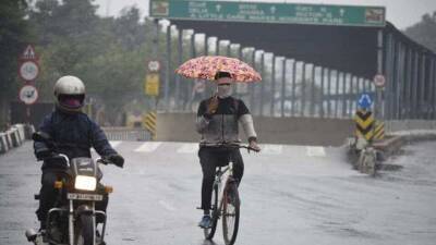
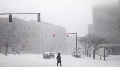
Winter storm will blast East Coast as powerful 'bomb cyclone' after bringing snow to Midwest, South
winter storm will bring snow from parts of the Plains and Midwest into the South through Friday night, then intensify into a powerful "bomb cyclone" as it blasts the East Coast with heavy snow and high winds on Saturday.As a strong upper-level jet stream plunges out of the West, it will spawn the development of a surface low-pressure system along a cold front in the lower Mississippi Valley.
That low will then rapidly strengthen as it tracks into the Northeast by Saturday and Atlantic Canada on Sunday.Meteorologists use the term bomb cyclone to describe a low-pressure system that undergoes "bombogenesis" – defined as a rapid pressure drop of at least 24 millibars in 24 hours or less – indicative of a very intense storm system.
In general, the lower the pressure, the higher the strength of the winds.According to David Roth, a meteorologist at NOAA's Weather Prediction Center, all-time record-low pressures could be set across portions of Atlantic Canada as this storm "bombs out" over the weekend.WHEN STORMS ‘BOMB OUT’: EXPLAINING HOW A BOMB CYCLONE FORMSThe National Weather Service has issued Winter Storm Warnings, Winter Storm Watches and Winter Weather Advisories from parts of the Southern Plains to the mid-South, Ohio Valley, Appalachians and interior Northeast.
Areas included in the Winter Storm Warnings are expected to see the worst driving conditions due to the snow, but hazardous travel is possible in all of these locations under winter weather alerts.Winter weather alerts stretch from the Southern Plains to the interior Northeast.(FOX Weather) This storm dumped more than a foot of snow in portions of western Kansas on Thursday, while the Kansas City, Missouri, metro area picked up between 2 and 5 inches of snow.HOW.
Read more on fox29.com


United States
|
Cases: 46 252 513
Deaths: 750 423
Recovered: 0
|

India
|
Cases: 34 321 025
Deaths: 459 652
Recovered: 0
|

Brazil
|
Cases: 21 835 785
Deaths: 608 235
Recovered: 0
|

United Kingdom
|
Cases: 9 215 683
Deaths: 141 607
Recovered: 0
|

Russia
|
Cases: 8 494 589
Deaths: 237 619
Recovered: 0
|