Summer 2023 weather: What to expect across Canada
The summer season is here and the forecast is looking hotter than normal for much of Canada. We are still in a very “blocky” pattern that features a large upper-level ridge in the middle of the country.
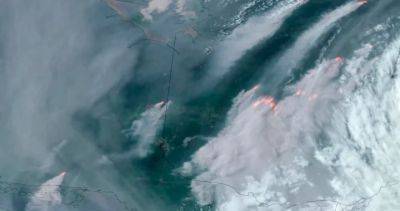
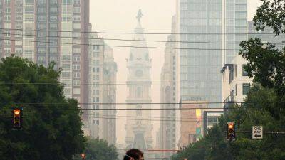
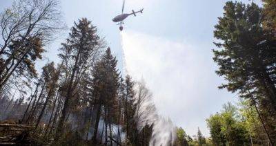
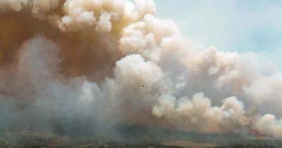
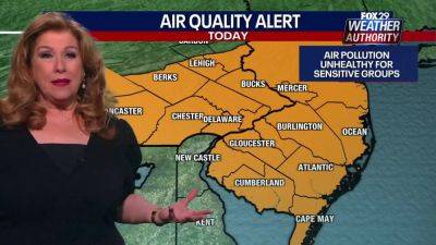
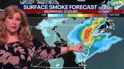
This has been an almost constant feature since the end of April and has led to record heat and extremely dry conditions as it oscillates back and forth from west to east.The blocking high is the main reason for a historic start to the fire season, in which millions of acres have burned in the west, the largest fire in Nova Scotia history continues to burn, and now dozens of lightning-induced wildfires are raging through Quebec.Smoke-filled skies have filtered the sun’s rays and reduced air quality at times from B.C.
all the way to Newfoundland and Labrador. High-temperature anomalies and low humidity will remain across the north for at least the next couple weeks before the ridge finally breaks down.Side note: These blocking patterns are notorious for lingering longer than expected and computer models sometimes struggle with how everything evolves.
Even after the block breaks down, smoke and northern wildfires will likely be with us through the summer months which could lead to one of the most active years on record.Another factor that will play an increasing role in the global weather pattern later this summer and into the winter is the developing El Niño.
Read more on globalnews.ca


United States
|
Cases: 46 252 513
Deaths: 750 423
Recovered: 0
|

India
|
Cases: 34 321 025
Deaths: 459 652
Recovered: 0
|

Brazil
|
Cases: 21 835 785
Deaths: 608 235
Recovered: 0
|

United Kingdom
|
Cases: 9 215 683
Deaths: 141 607
Recovered: 0
|

Russia
|
Cases: 8 494 589
Deaths: 237 619
Recovered: 0
|